UAS Range-Boosting Services
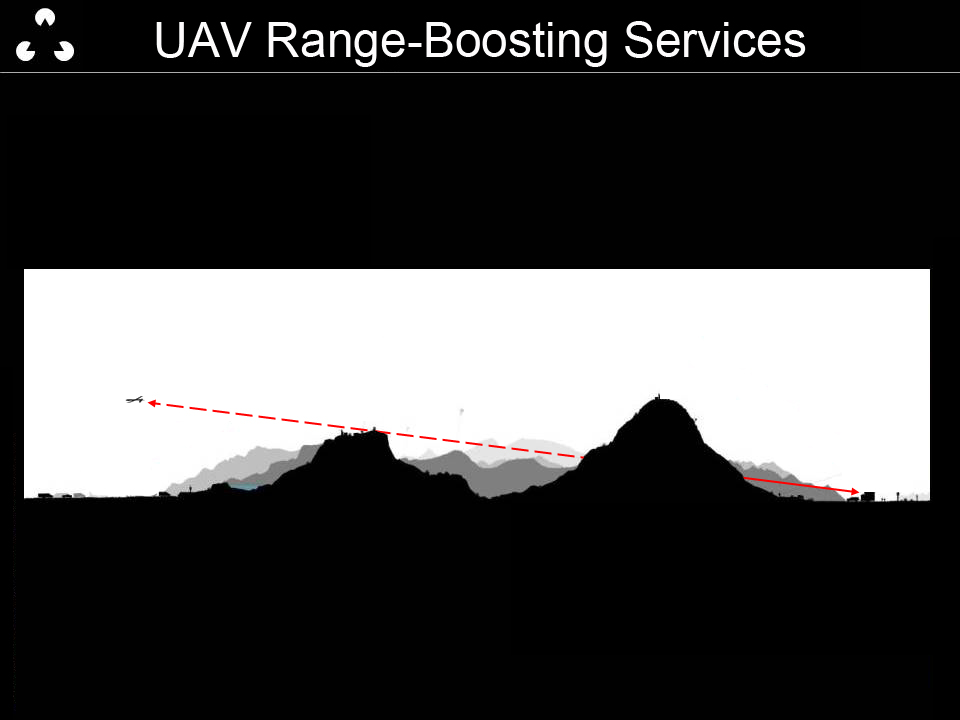
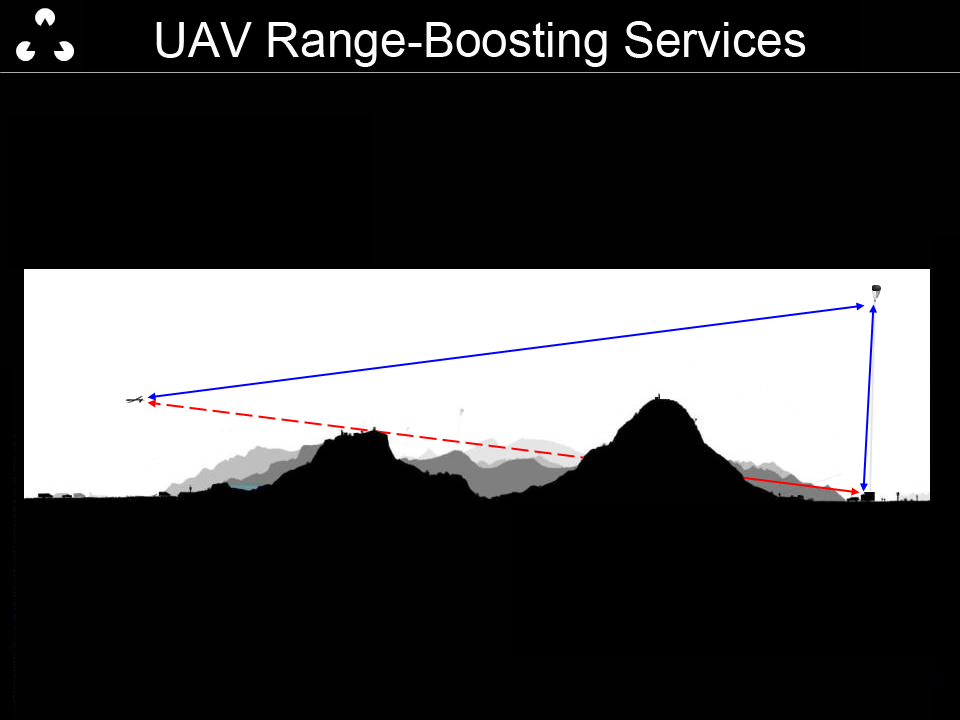
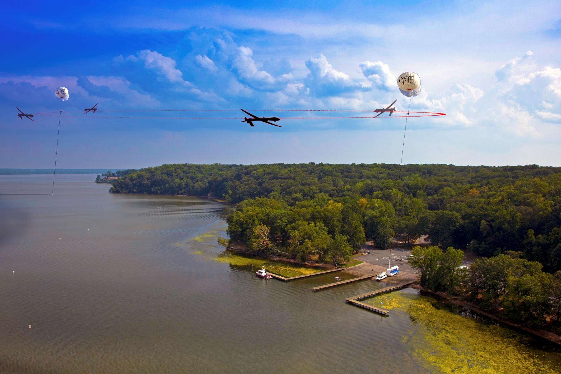
Line of sight radio signals are essential for steering an unmanned aerial vehicle and getting clear video signals back to the remote pilot. DDIS’s tethered balloons offer the ability to loft repeaters to 1000 feet in about 10 minutes. At this altitude, one can see an additional 30 miles. This elevated platform greatly expands the circle of coverage (and the market) for operating UAV’s in difficult terrain. Logistically this launch trailer deployed balloon avoids the costs of staging and maintaining repeaters on hard to access mountain tops.
Signal Boosting and Relaying Communications
Aerostat ServicesSafe Lost-Link Testing and Drone sensor Testing
Using the aerostat as a safe testing platform for unproven payloads and hardware, DDIS can safely loft and test equipment at altitude without the dangers of lost-link or catastrophic failures.
Aerostat & Drone ServicesDrone Delivery Support and Hardware
UAV Deliveries are on the horizon.
Launch and Recovery Services and Hardware
DDIS’s launch trailer can be adapted from lofting aerostats to launching and capturing fixed-wing drones in areas without runways or other safe landing areas.
Let Us Build You OneNeed a Custom, Turn-Key Launch Trailer?
Our specialized facility can accommodate aerostats, fixed-wing drones, and multirotor drones.
TRAILER CAPABILITIES
- Climate-controlled command center reduces crew fatigue during 24/7 deployments.
- 50’ EO/IR periscope mast with guy wires, which allow elevated surveillance platforms to operate in up to 40mph winds.
- Elevated observation deck improves staffs situational awareness with ability to look and listen in 360 degrees from 17ft off the ground.
- 240 v generator, 120 and 12 voltages allows redundancy and longer missions.
- Our mobile observation trailer can be towed at 60 mph, and set up for elevated RC/IR/EOS observations within 9 minutes of arrival.
- Fiber optic, coax, RS-232 or wireless connection from the mast to trailer-based monitoring station
OPTICAL SURVEILLANCE
- Elevated remotely controlled 50’ EO/IR periscope with powerful remotely controlled range finder binoculars. The data can be can be sent to TSA, FBI, or other airport security teams.
- State of the art 40“ HD display screens in dark room enhances ability discern small and distant drone images.
- Dedicated Artificial Intelligence algorithms to help classify common drone shapes (up to 1km). (AI training not included)
AUDIO SURVEILLANCE
- Optional “big ear” acoustical listening and recording device to improve ability to hear incoming drones. (Type and cost is TBD)
RF SPECTRUM SURVEILLANCE
- Elevated Radio Spectrometer antennas increases chance to detect the location of drones/ drone pilots. (Type and cost is TBD)
VISIBILITY DETERRENT
- Mobile Command center FAA red and white strobe lights, rooftop “Security” signage and powerful search light helps illuminate and potentially deter stealth drone attacks near runways at night.
RADIO REPEATERS
- Mast-based (or moored balloon-based ) encrypted radio repeaters to keep pilots and airport security communications staff connected when deployed at distant runway stake out locations
COUNTER DRONE MEASURES
- DDIS mobile field office can help host some of client’s counter drone equipment. This includes 220 v power supply and stealth elevated turret mounts for “RF Jamming” equipment.
- DDIS’s catapult for safe rapid launch of “chaser” drones, or small 20lb Radar dishes mounted to 49ft. panning masts.
MARITIME COVERAGE
- Since most major international airports are near maritime ports UAV-Monitoring offers rapidly deployed Mil Spec boat for shallow water patrols.
- Powerful stabilized range finding binoculars can be handheld or mounted on our 10 meter portable mast for an elevated survey of shallow coastal areas in heavy winds.
AERIAL PHOTOGRAPHY360° Field of View (HFOV) Coverage
Our custom camera clusters cam shoot in multiple directions at once, providing an effective 360° field of View (FOV). This can be set up for forensic documentation or live encrypted video downlink, depending on the Client’s needs.


