Natural Disaster RecoveryHurricane and Earthquake Damage Mapping
The staggering post-hurricane financial losses suffered by coastal populations demands accurate and unbiased time-lapse aerial documentation. Aerial views and damage analyses are essential for efficient organizing and processing of insurance claims. DDIS can quickly and efficiently map our an area with a quadcopter, fixed-wing drone, or our surveillance aerostat.
DDIS’ unique tethered surveillance aerostat systems are custom built to provide infrared, multi-spectral and daylight aerial documentation following a disaster. More importantly DDIS staff are specialized in producing and analyzing photogrammetric surveys. This allows remote decision makers to quickly quantify and evaluate the most important or costly damage. Policy holders, and municipalities can use our on-line aerial panoramas and overlay maps to distinguish and quantify the extents and depths of flood waters. Unlike consumer drones footage, our surveillance balloon’s virtual 9-Eye camera platform captures, geo-locates and prioritizes ultra high resolution 360 degree views. Our mobile control center, 50 ft antenna masts, 16 ft zodiac tow boat and launch trailer are designed to rapidly get payloads in the air, including communication repeaters Note: Because our aerial balloon platform is tethered the FAA and security agencies grants us airspace permissions whereas unmanned drones are often banned or are limited in range, duration and image quality.
DDIS’ unique tethered surveillance aerostat systems are custom built to provide infrared, multi-spectral and daylight aerial documentation following a disaster. More importantly DDIS staff are specialized in producing and analyzing photogrammetric surveys. This allows remote decision makers to quickly quantify and evaluate the most important or costly damage. Policy holders, and municipalities can use our on-line aerial panoramas and overlay maps to distinguish and quantify the extents and depths of flood waters. Unlike consumer drones footage, our surveillance balloon’s virtual 9-Eye camera platform captures, geo-locates and prioritizes ultra high resolution 360 degree views. Our mobile control center, 50 ft antenna masts, 16 ft zodiac tow boat and launch trailer are designed to rapidly get payloads in the air, including communication repeaters Note: Because our aerial balloon platform is tethered the FAA and security agencies grants us airspace permissions whereas unmanned drones are often banned or are limited in range, duration and image quality.
Orthomosaics and Photogrammetry
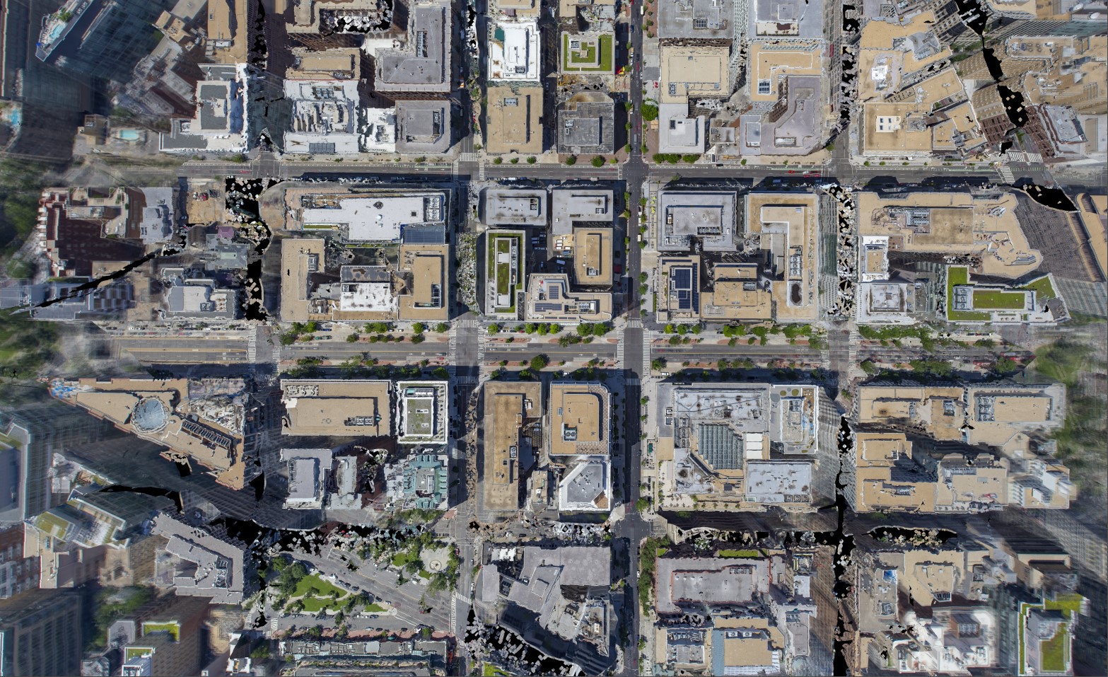
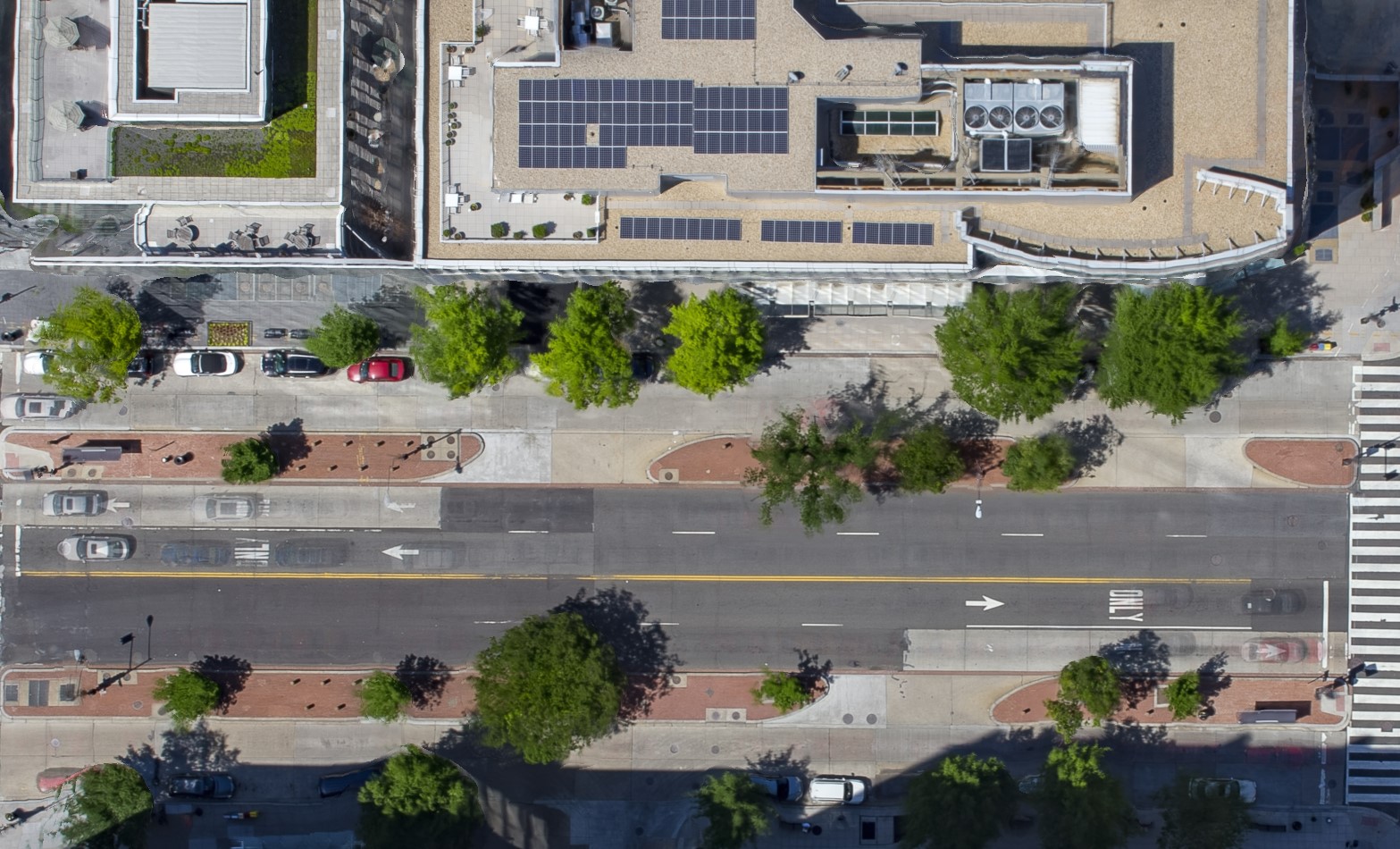
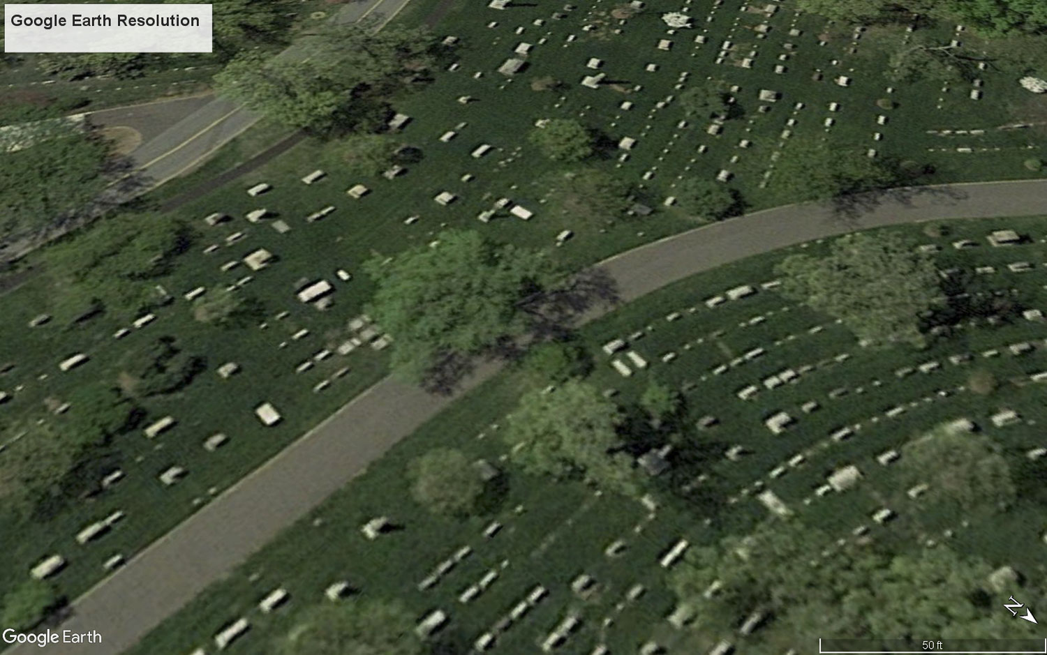
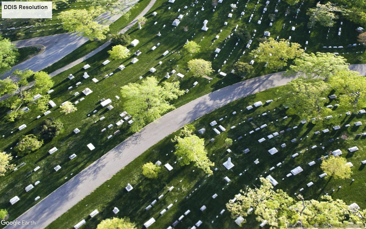
We can map large outdoor areas for preliminary survey and documentation needs. By designing a capture strategy for our aerial platforms and pairing it with high-end stitching photogrammetry software, we can produce high-resolution orthomosaics, 3D models, point clouds. While these are usually captured with a daylight camera, we can also capture these with an thermal (IR) camera.
Click on Blinking Icon above
Mapping with 360° Footage
Spherical Panoramas are effective tools, which provide 360° degree fields of view from above each sight. By capturing outward-looking images from our camera-cluster at a specific height and location, DDIS is able to determine the visual impact of anything located at that point in space. In other words, if the camera can see you, you can see the camera. This simple concept, paired with our unique aerostat technology allows us to provide quick and comprehensive visual impact studies, saving our Clients, time and money. To give a simple example of its application, a R.L.O.S. is able to effectively create a quick and accurate way of determining which of the surrounding areas would be able to view signage positioned on the new development. Our aerial 360° tours, crane photography, real estate drone photography, balloon photography, and other aerial tools will take your development marketing and analysis to the next level.
AERIAL PHOTOGRAPHYOrthorectified Maps
the same platforms that we use to create beautiful marketing imagery can also be used to capture and generate high-resolution point clouds and 3D models using photogrammetry software. Whether it is a vertical façade of a skyscraper for NYC Local law 11 or a ground plane that you need surveyed, we have you covered.
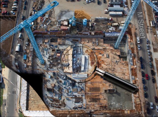
CONSTRUCTION DOCUMENTATION
360° Orbital Coverage from End of Jib / Hook Block
Monthly or Bi-Weekly Documentation
Minimal to No Insurance Requirements
No Airspace Waivers Needed
4 Cardinal Dir. can be captured in Approx. 15 min.
$800/ Month for 4 Inward-Facing wide Stills. NSEW
$1,200/ month for 16 Cardinal Directions
Minimum Duration: Monthly for 1 Year.
*We also document large-scale projects with our aerostat and/or drones.
Infrared (IR) Rooftop and Façade Scanning
Using the highest commercially available resolution infrared camera, Digital Design & Imaging Service can effectively provide a thermal audit of the exterior envelope of a building. By using drones, aerostats, or manned aircraft, DDIS can provide a quick, safe, and cost-effective means of capturing high-resolution, radiometric, IR imagery and data. DDIS will design and implement a custom IR capture strategy for each building envelope we analyze. This often means dividing the facades and roof into sections, which are then documented with thermal imaging and visible spectrum photography.
• Large-Scale Exterior Building Envelope (Rooftop and Facade) Inspection.
• Moisture and Heat-loss Detection.
• Overheating Equipment
• Environmental Inspection
• Aerial Visual Pipeline and Transmission Line Inspection
• Long-term Aerial Thermal Surveillance
• Public and private balloon tests.
• Expert witness testimony services.
• Aerial 360° Reverse Line-of-Sight interactive media from the tops of key structures as a means to instantly capture and present the maximum visual impact of a structure on its environment.

