Let Us Help You Determine Your Visual Assets!
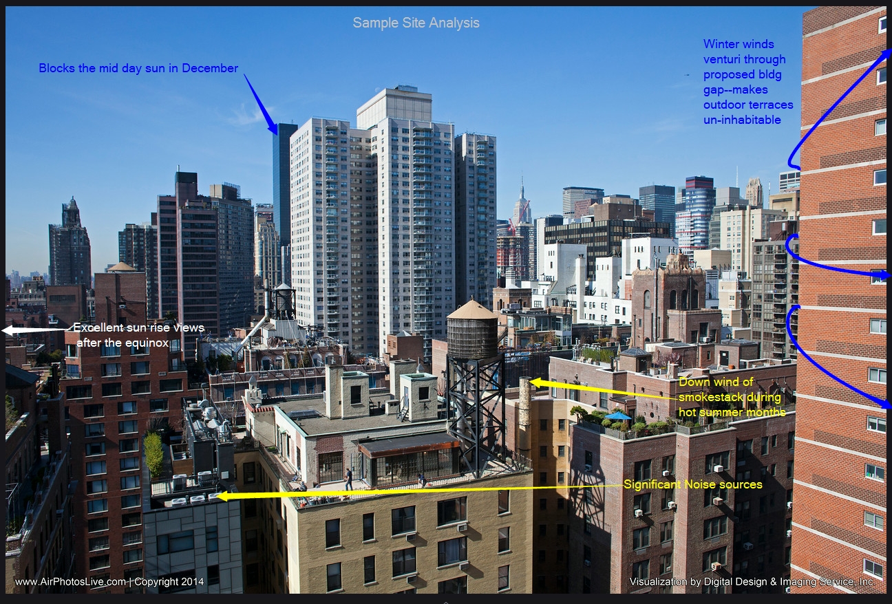
Engineers, Architects, investors all benefit when accurate aerial viewsheds are calculated and captured from key floors of a proposed building or tall structure. A proposed building’s key assets are its exposure and likely views from certain apartment units. The potential viewsheds that cover the area’s iconic architecture are needed by the Architect in the beginning of the conceptual drawings. They are also invaluable for potential investors and tenants worldwide. Accurate aerial perspectives, captured from realistic vantage points, are critical for locating windows, balconies, columns, air conditioners and rooftop garden features. DDIS view photography and analysis services help clients evaluate, price, and analyze the best and worst views from various altitudes above a plot of land. Our annotated overlay’s and callouts communicate the value of a property to brokers, engineers and potential tenants.
360° Interactive Aerial Panoramas (Virtual Tours)
Our 360° footage resolution ranges from 4k 1“ sensor drone cameras to full-frame 35mm 26mp+ camera clusters. This increased in resolution and magnification allows a viewer to more accurately understand what a human eye would see from this vantage point. It also allows marketing campaigns to capitalize on its higher resolution for print purposes. Imagine panoramas that could be wrapped around buses.
AERIAL PHOTOGRAPHYMarketing & Viewshed Analysis
360° VR Panoramic views from:
– Key Floors
– Corner Offices
– Amenity Decks
– Penthouses
Crane-Mounted Sensor Cluster may include: DSLR Cameras | IR Cameras | Sound pollution recording equipment | RF Analyzing equipment | Others
Need a Map? We can add an informational overlay!High-Altitude Contextual Maps and Views
Crane-Mounted 360° Veiwsheds

Helping Our Clients See Beyond the HorizonViewshed Planning & Analysis
It is impossible to judge the quality of a proposed rooftop space just from the architect’s blueprints. For this reason we offer a unique rooftop preview and simulation service and advice. Our aerial data directly supports your pricing and sales of key units. in proposed residential towers.
As a landscape architecture-focused consulting firm, we are able to predict and document many negative environmental influences in advance. We can capture the decibel level and direction of nearby noise sources. We can measure and predict the relative wind speed, gusts, wind direction, and direct solar exposure for a particular balcony or penthouse unit. These microclimate studies are critical for predicting the success of comfortable communal spaces, solariums, pools, and productive gardens.
We are able to simulate 360° coverage from specific locations above proposed skyscrapers. We help our Clients determine the best way to capitalize on their views by analyzing sun angles, local winds, nearby noise sources and future blockages. Our unique aerostat balloon technology allows us to simulate the proposed height of cell towers, water tanks, power lines or skyscrapers. The public can see the height of a proposed structure in context to other adjacent structures. This accelerates zoning board decisions. This saves our clients time & money. Our aerial 360° tours, crane photography, real estate drone photography, balloon photography, and other aerial tools will take your development marketing and analysis to the next level.


